
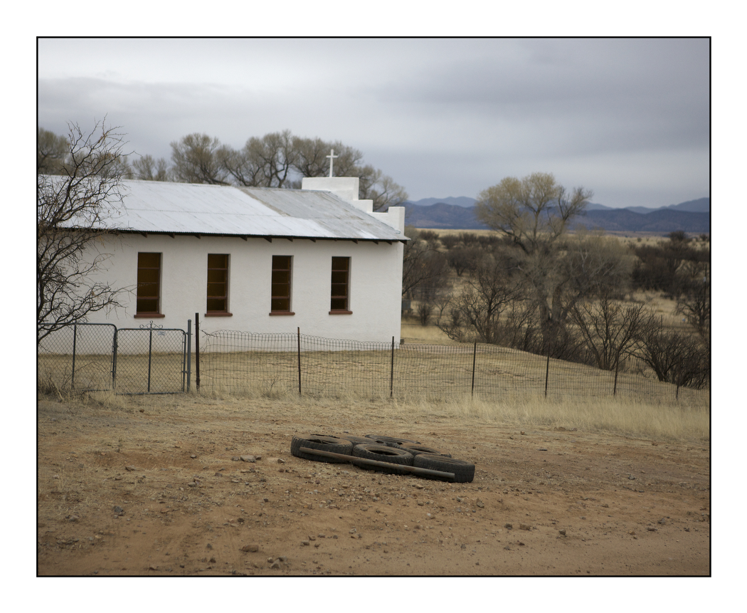
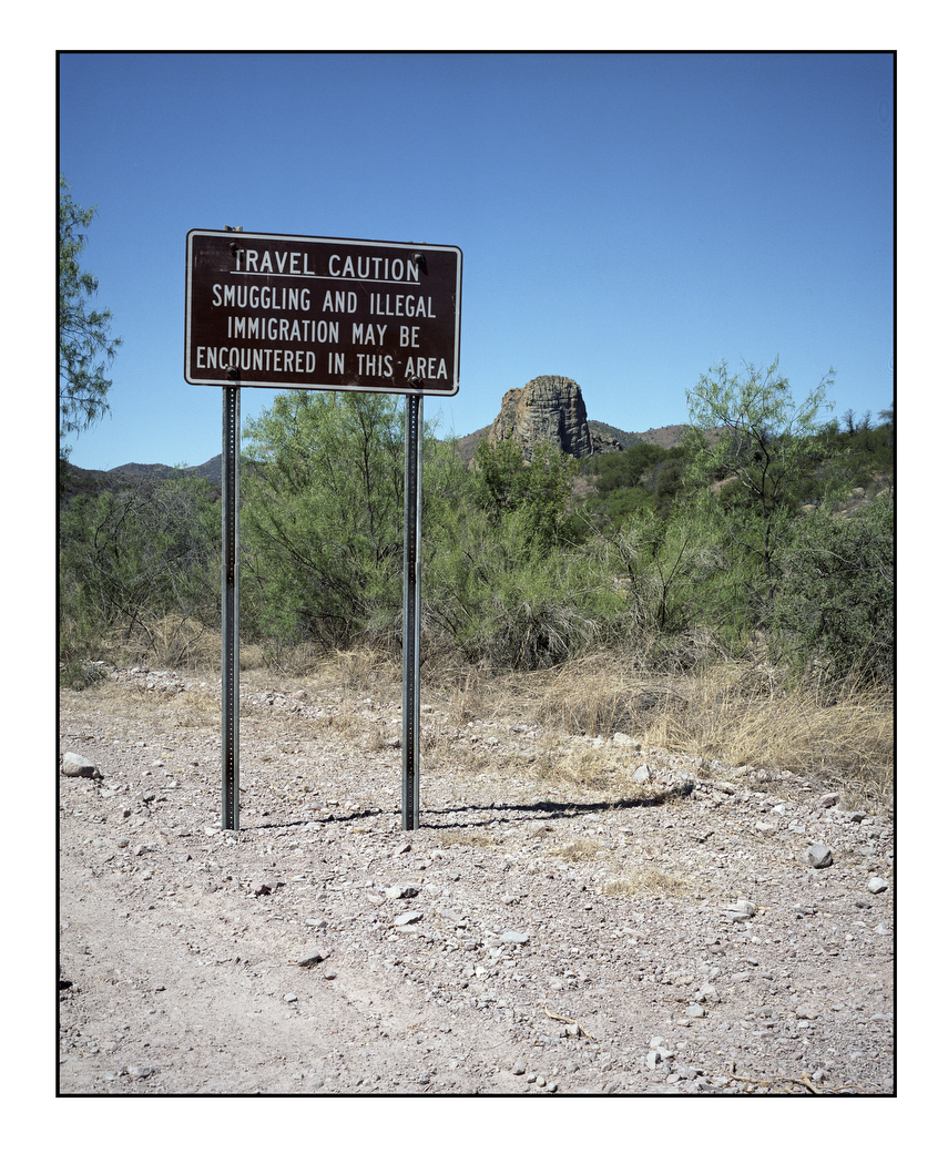
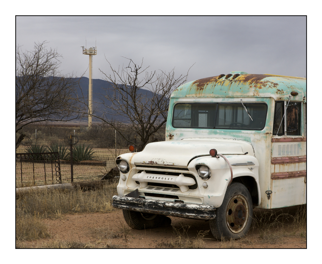
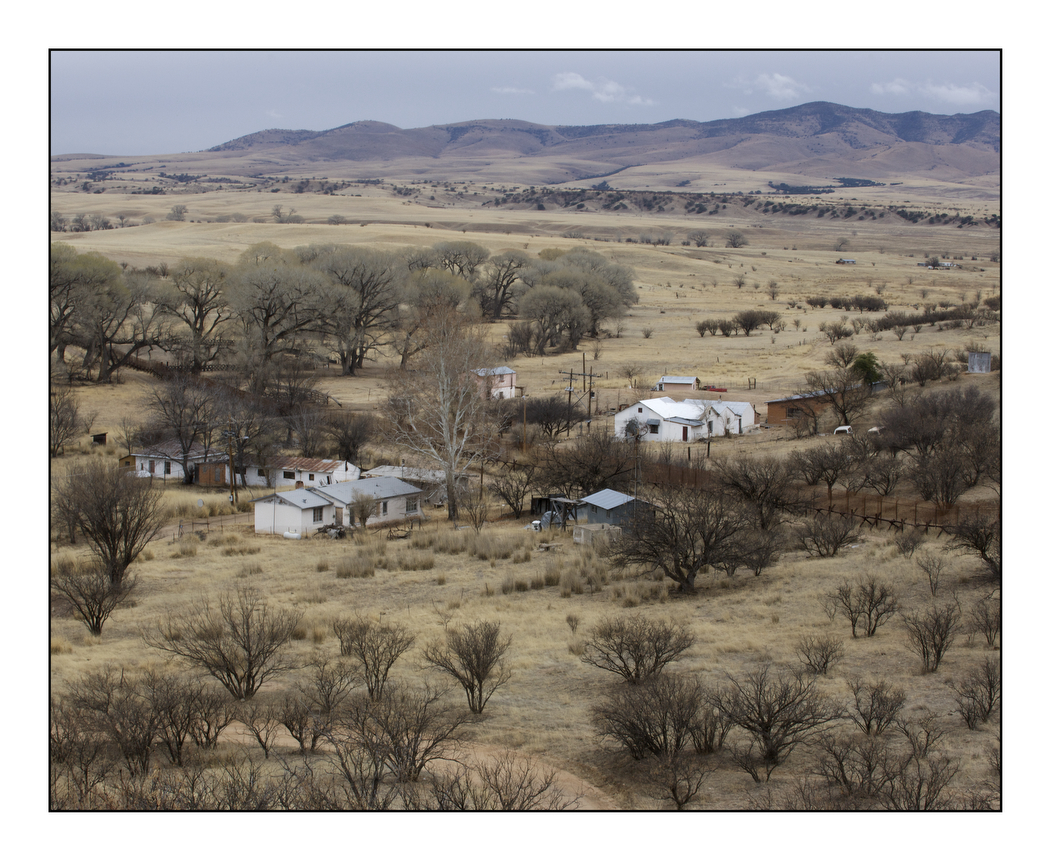
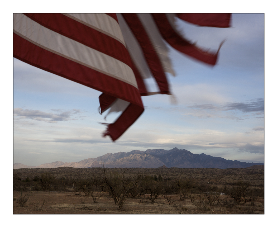
In October 2010 I was driving across the Sonora Desert in southern Arizona, following the Mexican border between Douglas and Yuma in the footsteps of Francisco Vásquez de Coronado, the Spanish conquistador who crossed into what is now the United States in 1540. As I drove deeper into the desert I could see the architecture of immigration: the long border fence, the U.S. Border Patrol camps based in metal containers, the surveillance technology. I could also see traces of migration on the ground: old campfire sites and scraps of clothes on barbed wire fences. Each year hundreds of thousands of illegal immigrants attempt the crossing into the U.S., risking death along the desert trails or in the mountains. After returning from the border I began work on a project that addressed the issue of immigration through the landscape.
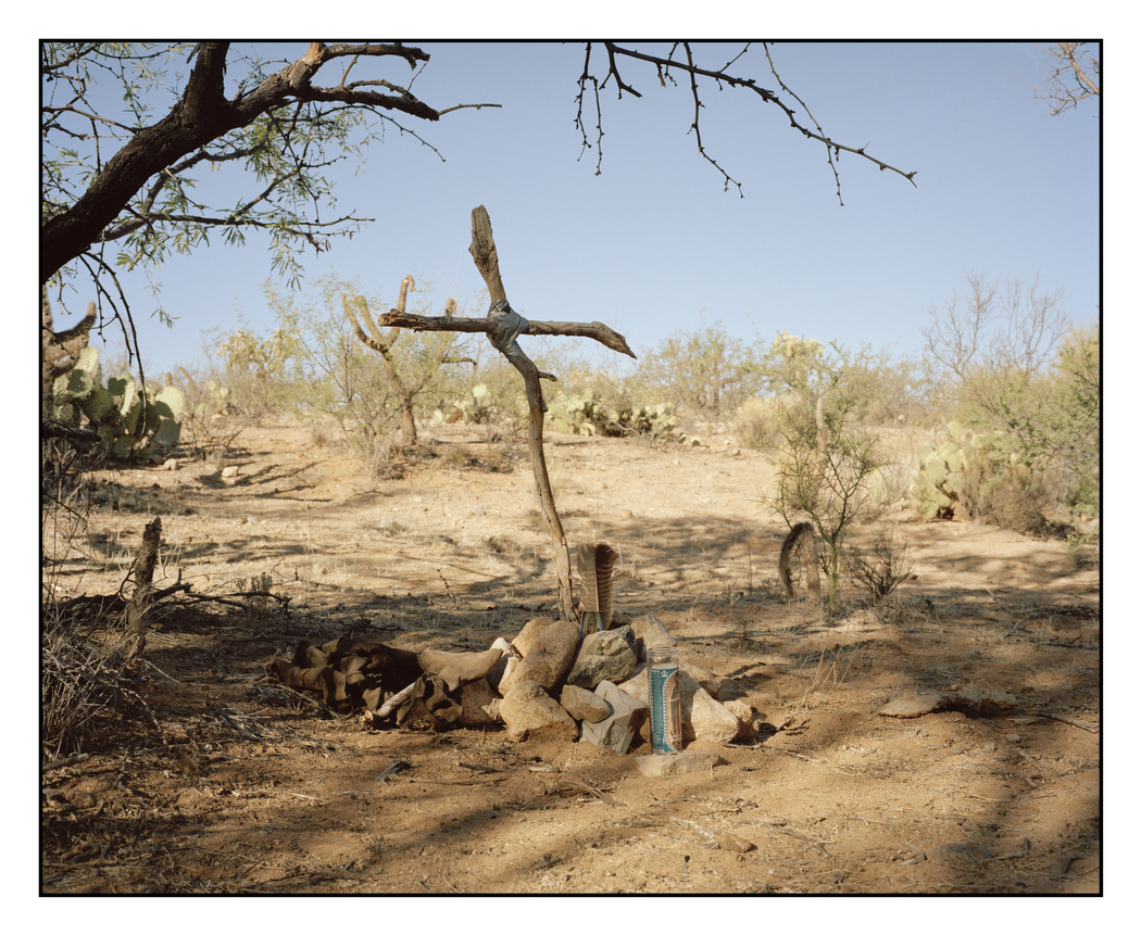
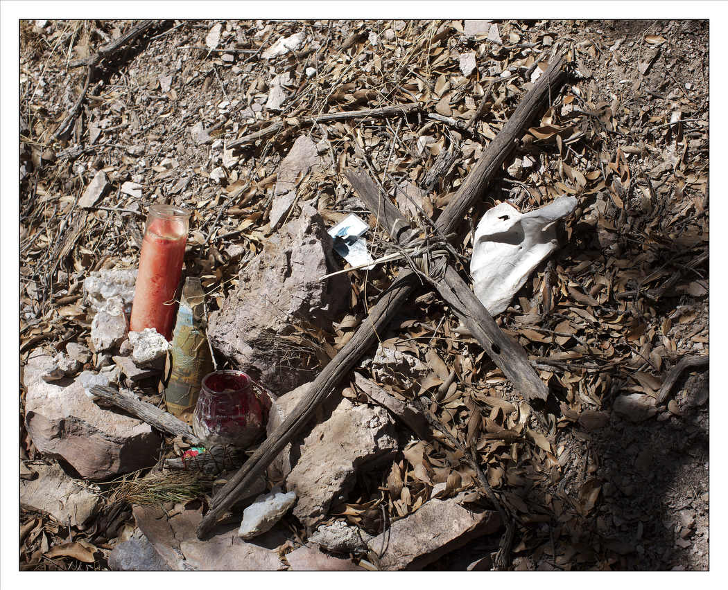
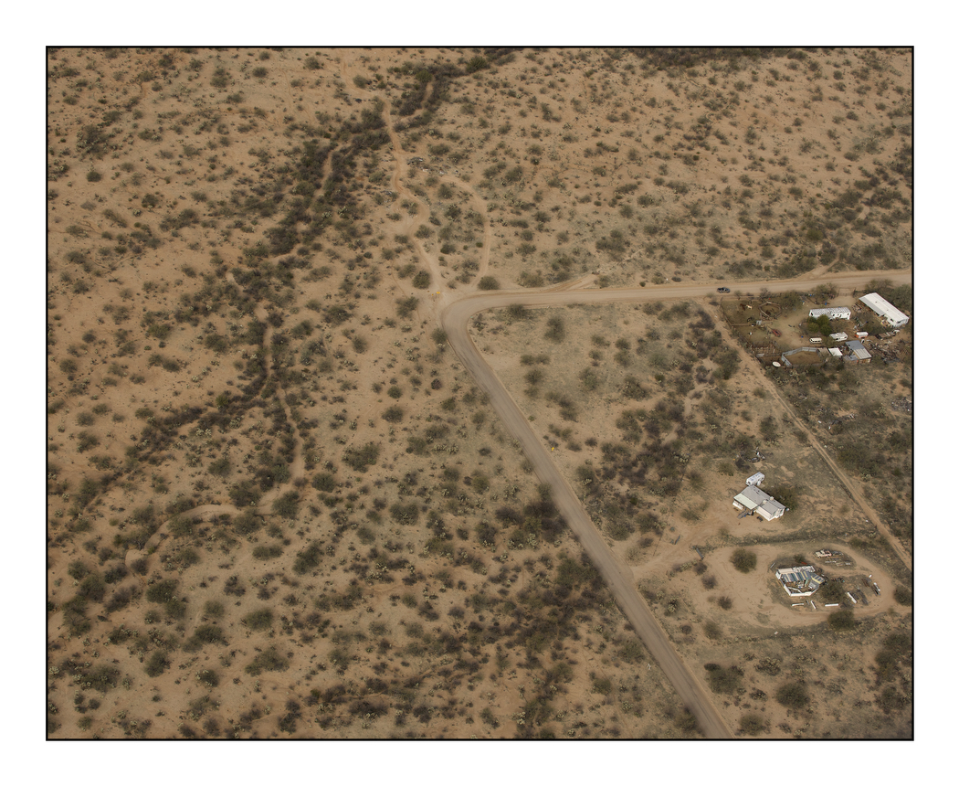
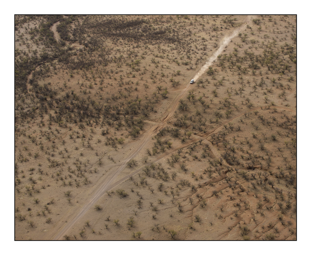
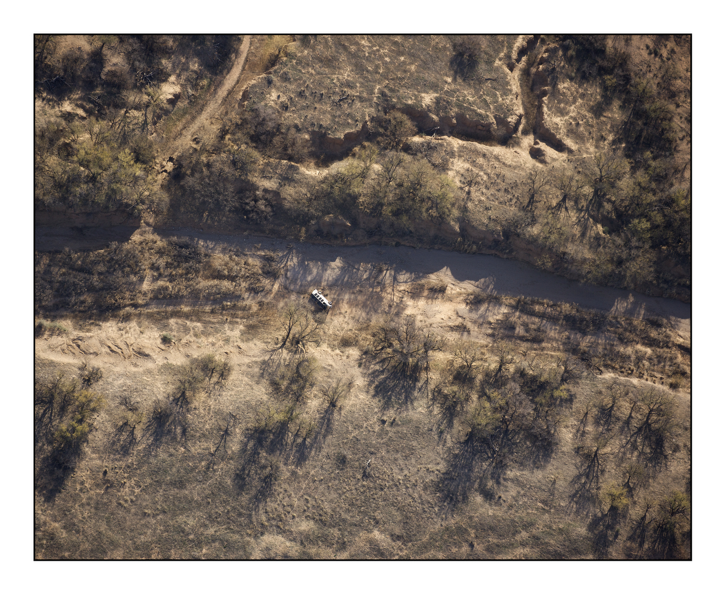
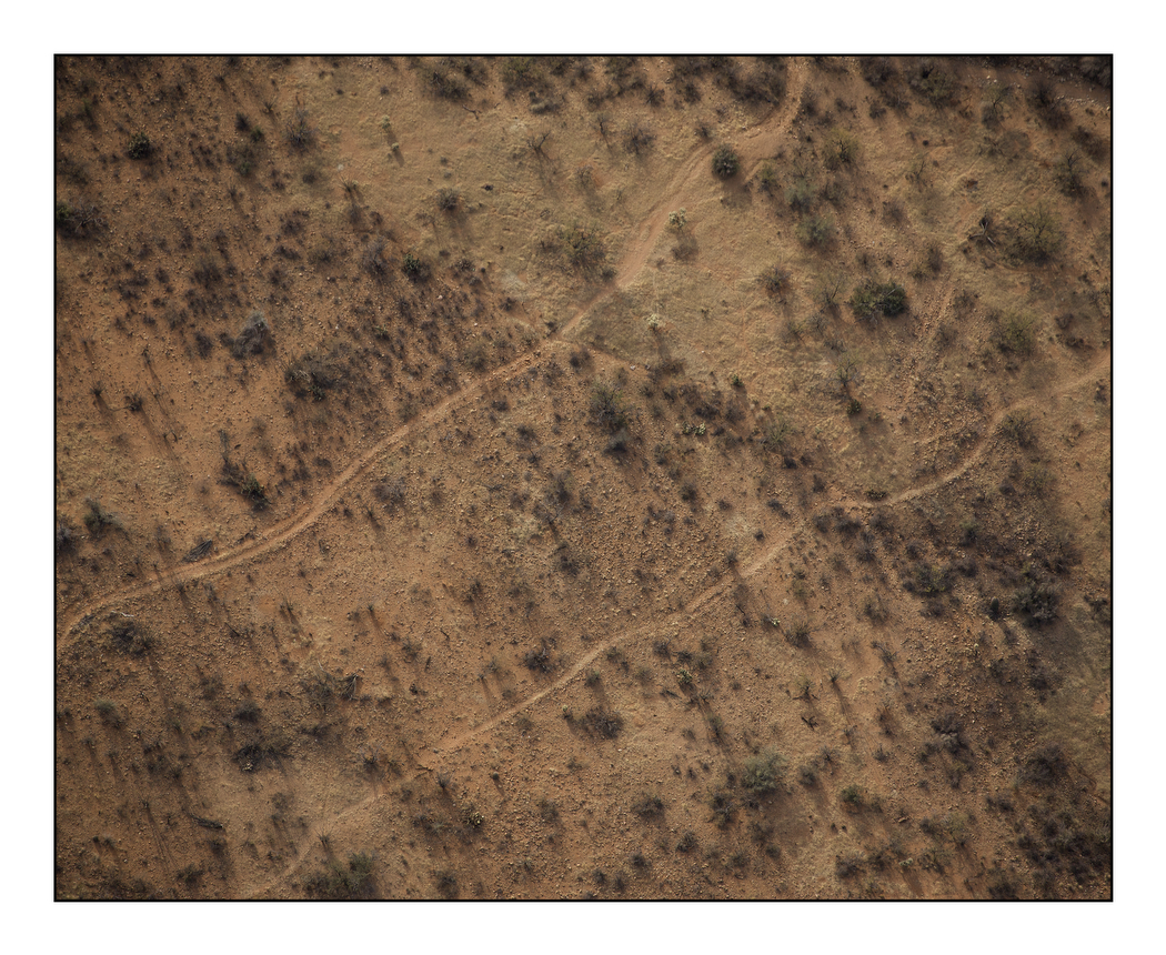
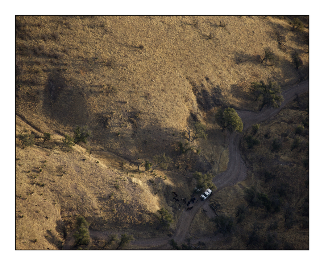
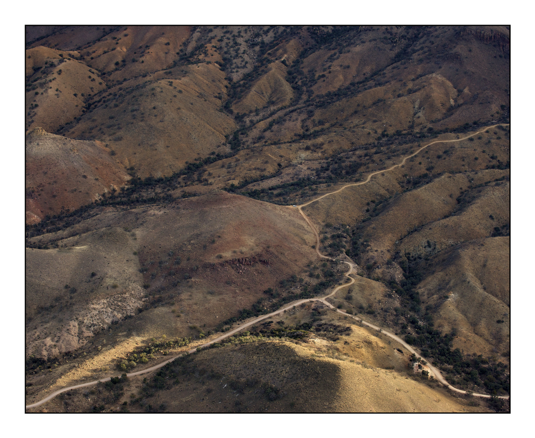
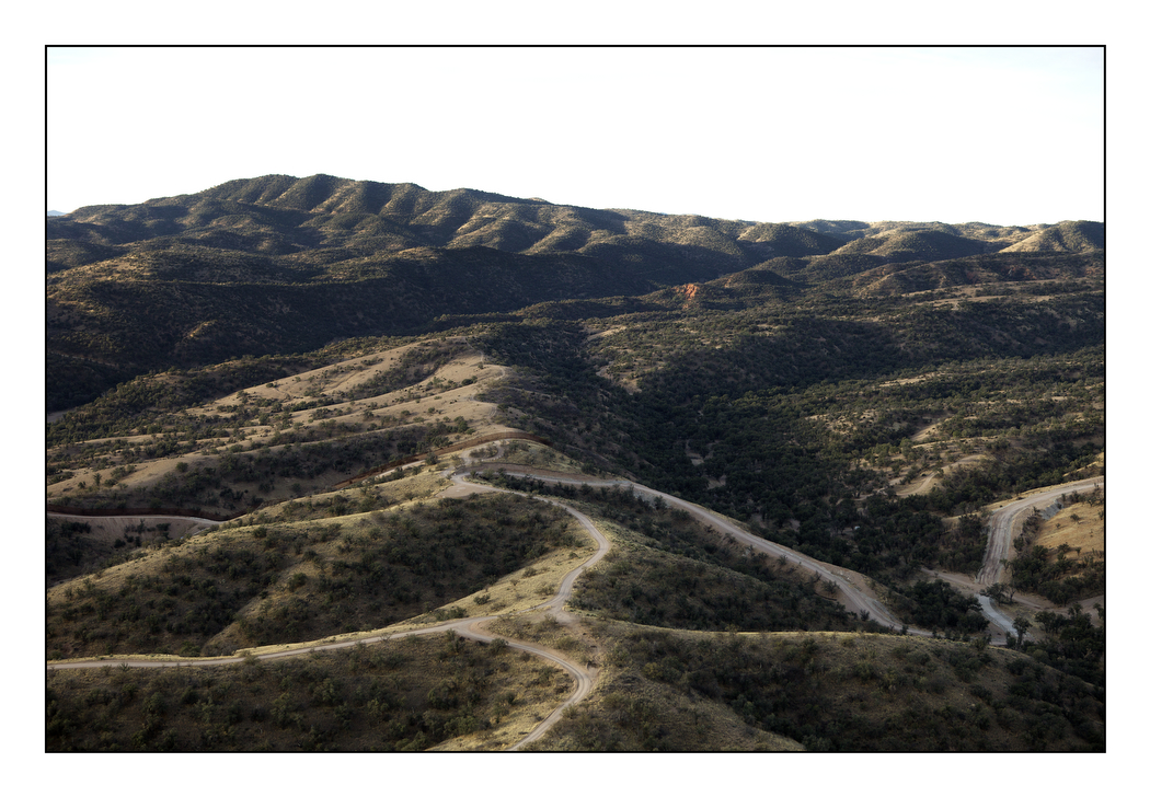
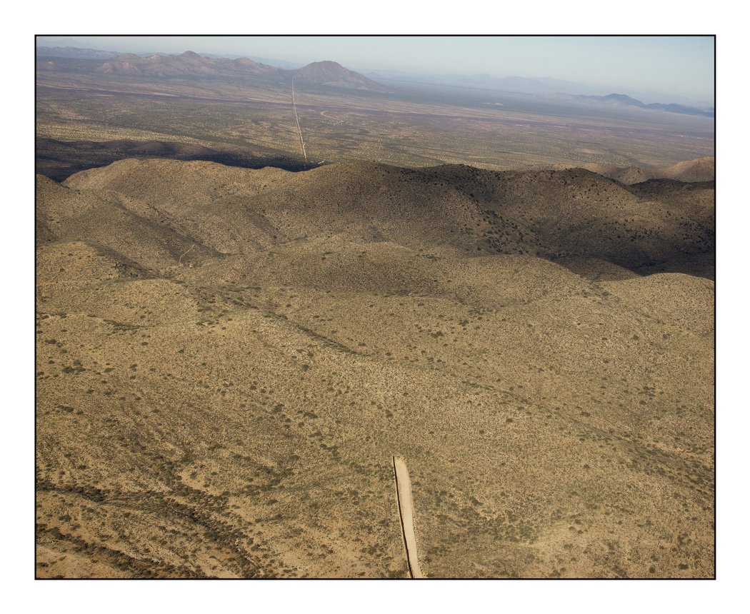
Thanks to a friend at the University of Arizona, I found Bob Kee, who is attached to the Tucson-based NGO, The Samaritans, a church-based group of volunteers who go out at weekends to look for migrants in distress on the desert trails. I made several trips with Bob, often coming across remains and shrines – candles and coins left by migrants at the graves of those who had died during their passage. But to tell the story of migration through the landscape needed scale. I climbed the parched Baboquivari Mountains that rise out of the desert floor but I could never get high enough, or vertical enough. So Bob introduced me to Sandra Lanham, a pilot who has flown the desert for decades working for environmental agencies and NGOs on both sides of the border. With Bob in the back seat of her Cessna with his GPS we swooped over the desert looking for the trails we had walked.
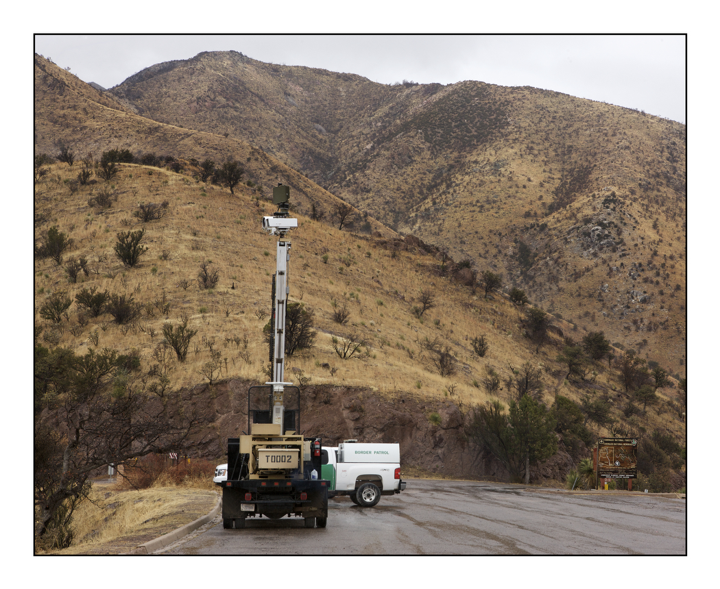
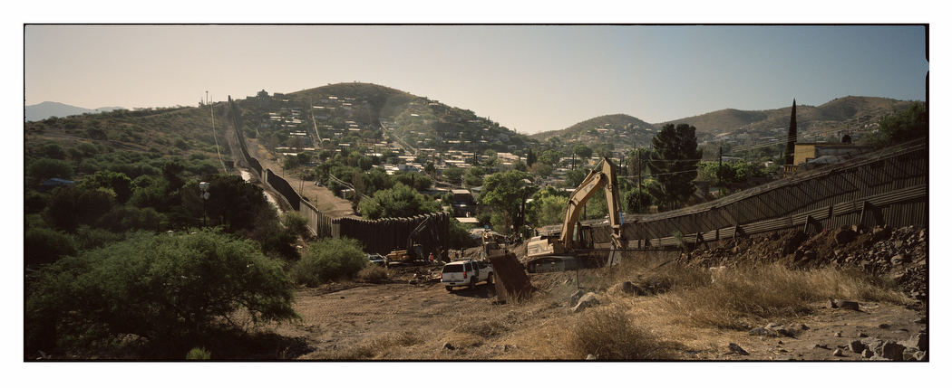
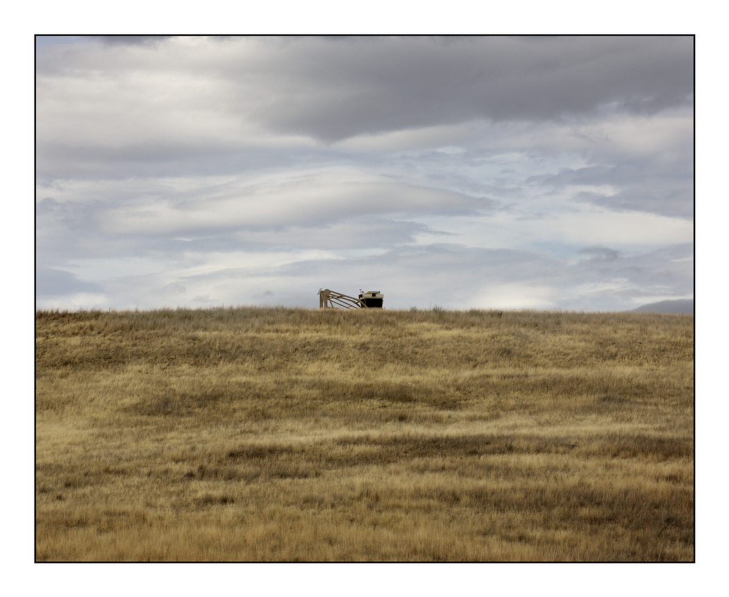
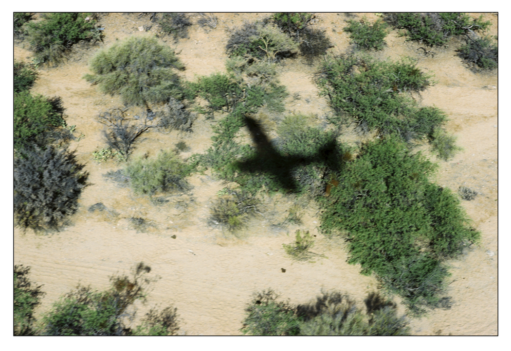
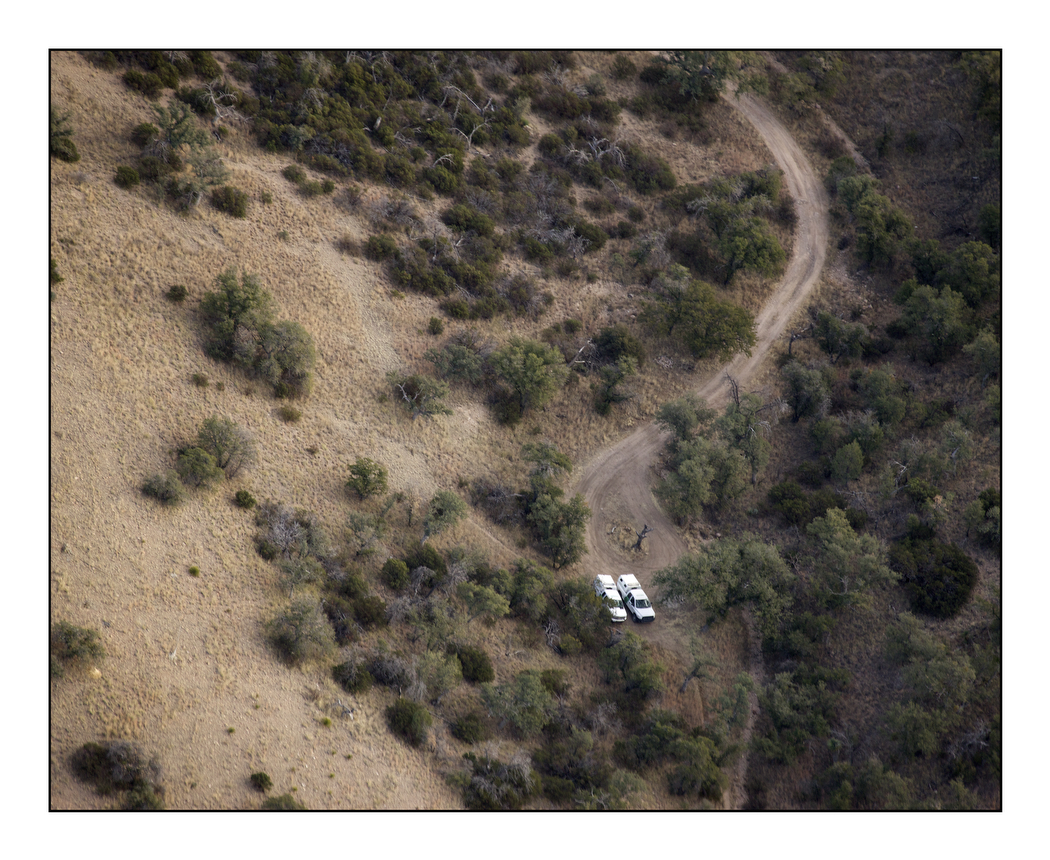
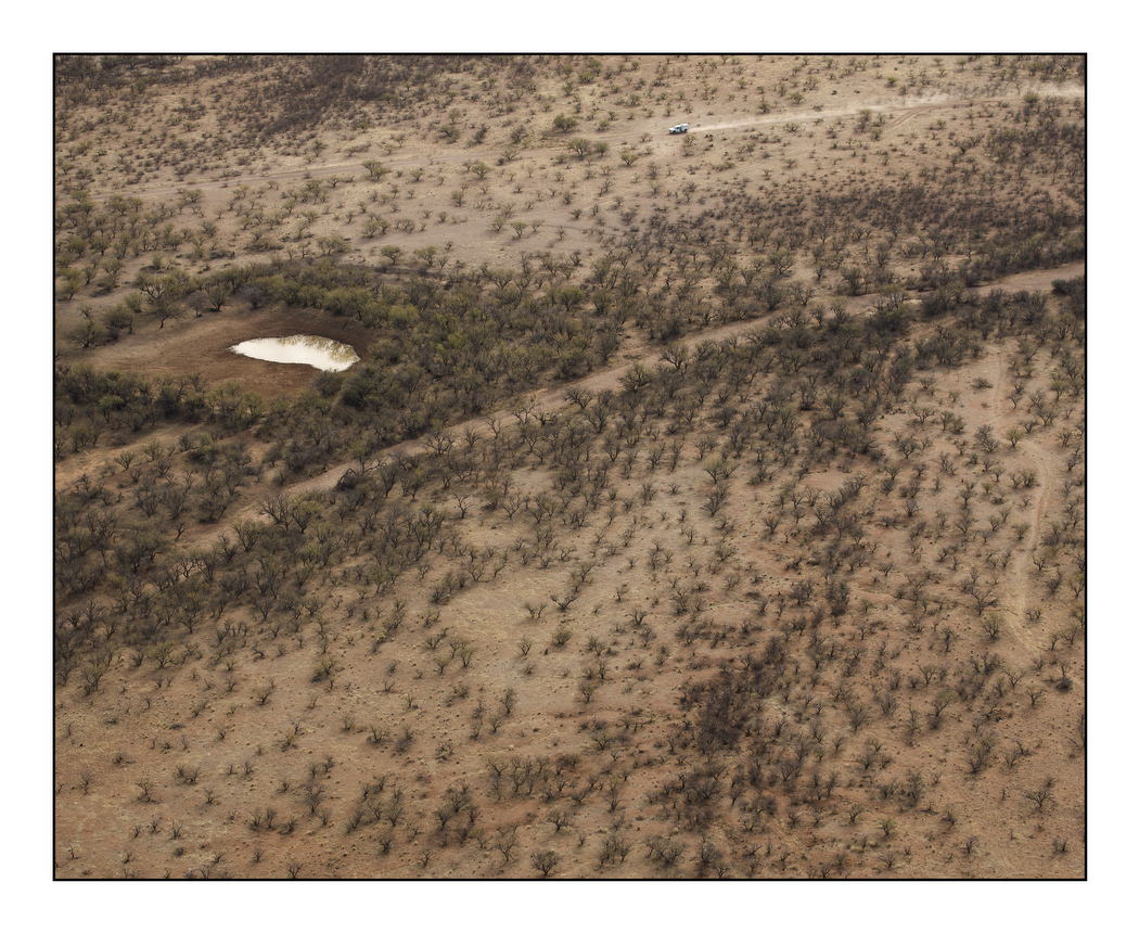
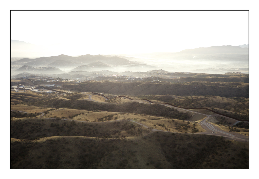
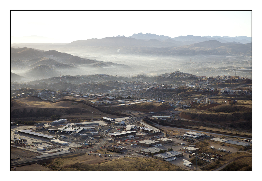
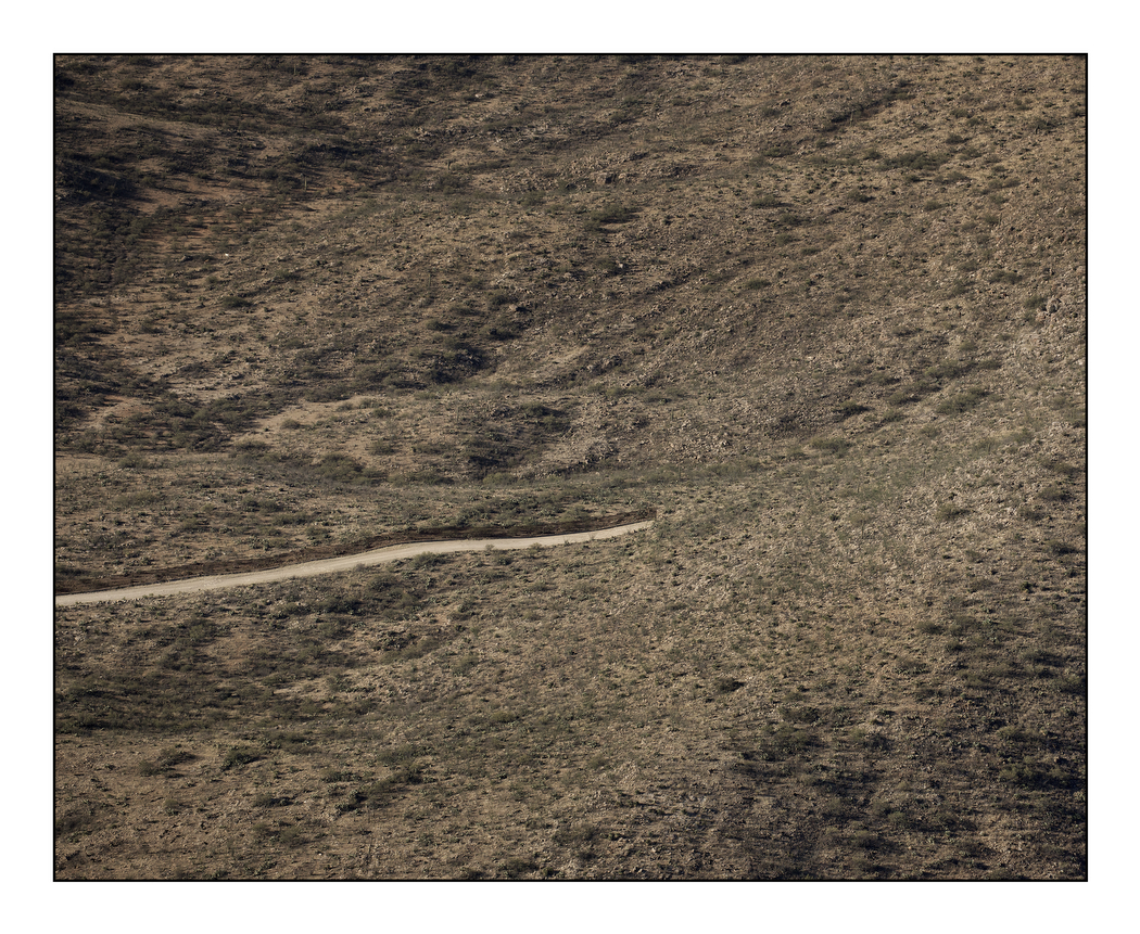
From the sky we saw the barrier that Homeland Security has erected as it carves through the desert and the trails made by migrants pursued by “La Migra,” the U.S. Border Patrol. Overturned cars and patrol trucks dotted the landscape like children’s toys. Seen from above, the apparatus of border security looks more like the borders of North and South Korea or Israel and Palestine than a country at peace with its neighbours.
The steel fence cuts through four U.S. states, from the southern tip of Texas to the Pacific coast of California. At $15 million per mile, guarded by private security firms and U.S. Customs & Border Patrol, the fence has cost $1 billion dollars so far. New technologies used to track suspected terrorists and insurgents in Afghanistan and Iraq are adding a further $755 million to the bill. According to the U.S. Health Resources and Services Administration, if this border region were to be made the 51st state of the Union, it would rank last in access to health care, last in per capita income and first in the number of children living in poverty.
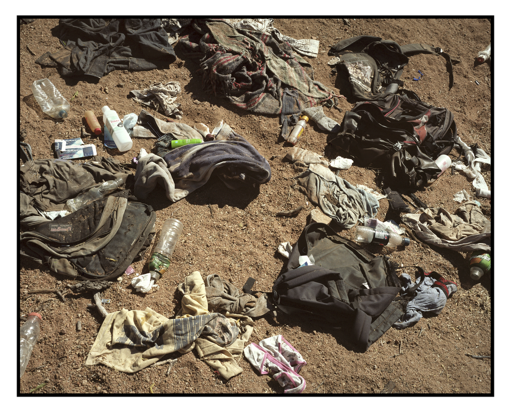
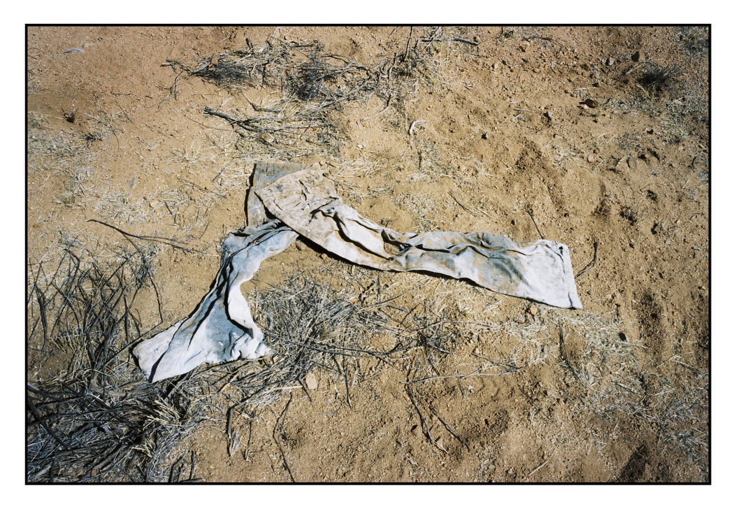
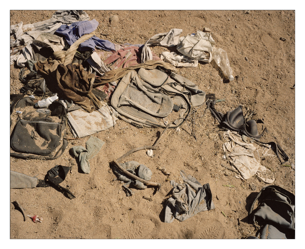
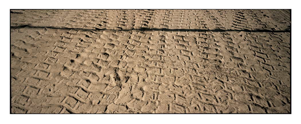
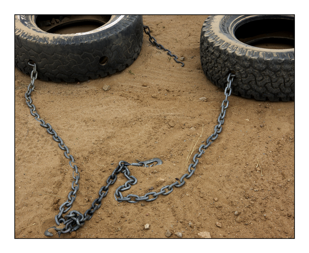
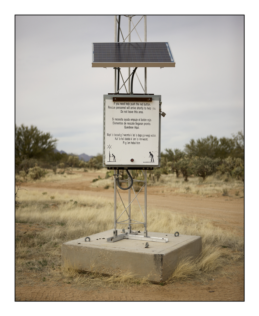
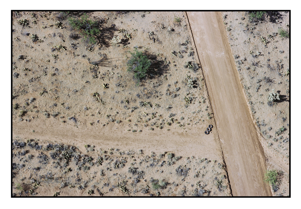
Back in the dirt I saw further signs of the patrol – car tires chained together and dragged behind trucks to sweep the trail at dusk so that any new tracks will be visible at dawn, emergency beacons for migrants in distress who can walk no further, water containers left by sympathetic NGOs – and more signs of human passage: discarded clothing, blankets migrants use to wrap the soles of their shoes to cover their tracks and more shrines to the dead.
According to the U.S. Customs and Border Protection agency, CBP, the number of illegal migrants apprehended at the Mexican border has fallen dramatically in recent years, from 858,638 in 2007 to 327,577 in 2011, a drop of almost 62 percent. There are now 22,000 Border Patrol Agents (their numbers were doubled in 2005) who work alongside the Army, the National Guard, Homeland Security and local law enforcement agencies. Local vigilantes and militias join them at weekends. The CBP also employs six 10,000 pound Predator drones, at $20 million each, manufactured by General Atomics, identical – except that they are unarmed – to those used in Iraq, Afghanistan and Pakistan. These fly between Yuma, Arizona and Brownsville, Texas at $3,000 per hour. Equipped with day and night vision technology and as silent as paper darts, some argue that they are about as effective: in 2011 nine drones deployed all over the USA found only five percent of the drugs that were found by 14 cheaper manned aircraft.
In their desperate attempts to evade the drones or land-based thermal imaging technology, the migrants are forced to skirt the steel fence and watchtowers and cross the harshest mountainous desert terrain where the fence is too expensive to build. They die horrible deaths on remote trails and deer paths, paths that overlook new settlements with names like Desert Bell populated by second-generation migrants from Europe. This is a landscape in which humans are scorched into the desert sand like dead livestock, and where thousands of women and girls have been raped, the privilege of young men called Coyotes who peddle humans unimpeded by fear of justice.
But although the number of illegal migrants caught crossing the border has fallen, the number of migrants found dead has not. In 2011 the CPB recorded 368 dead compared to 398 in 2007, a five-year average of 386 per year. According to local border organizations such as the Samaritans, as the crossing has become more difficult, the number of migrant deaths is rising. We can never know with any accuracy how many people succeed in the crossing, or how many die in the attempt. In both cases they disappear into the landscape.